New satellite-based algorithm pinpoints crop water use and management
- Like
- Digg
- Del
- Tumblr
- VKontakte
- Buffer
- Love This
- Odnoklassniki
- Meneame
- Blogger
- Amazon
- Yahoo Mail
- Gmail
- AOL
- Newsvine
- HackerNews
- Evernote
- MySpace
- Mail.ru
- Viadeo
- Line
- Comments
- Yummly
- SMS
- Viber
- Telegram
- Subscribe
- Skype
- Facebook Messenger
- Kakao
- LiveJournal
- Yammer
- Edgar
- Fintel
- Mix
- Instapaper
- Copy Link
Posted: 23 March 2020 | Sam Mehmet (New Food) | No comments yet
Researchers have developed a new high-resolution mapping framework which aims to precisely estimate evapotranspiration – said to be key in managing crop water use and farm efficiency.
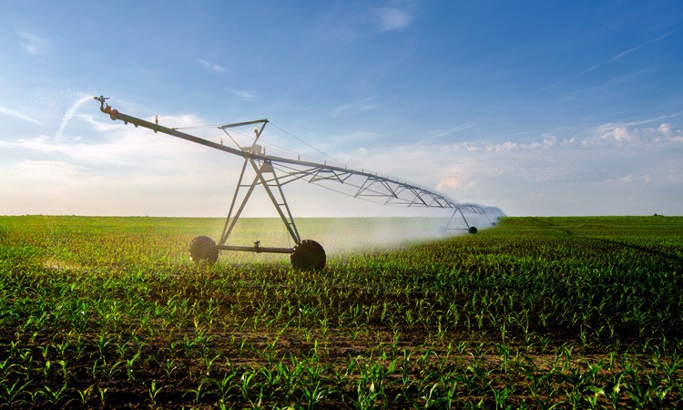
The growing threat of drought and rising water demand have made accurate forecasts of crop water use critical for farmland water management and sustainability.
But limitations in existing models and satellite data pose challenges for precise estimates of evapotranspiration – a combination of evaporation from soil and transpiration from plants, according to researchers. The process is said to be complex and difficult to model, and existing remote-sensing data often struggles to provide accurate, high-resolution information on a daily basis.
Researchers with the US Department of Energy’s Center for Advanced Bioenergy and Bioproducts Innovation (CABBI) at the University of Illinois at Urbana-Champaign have developed a new high-resolution mapping framework called BESS-STAIR which aims to resolve the issue. BESS-STAIR is composed of a satellite-driven biophysical model integrating plants’ water, carbon and energy cycles – the Breathing Earth System Simulator (BESS) – with a generic and fully automated fusion algorithm called STAIR (SaTellite dAta IntegRation).
The framework was tested in 12 sites across the US Corn Belt, and its estimates have reportedly achieved the highest performance reported in any academic study so far.
“BESS-STAIR has great potential to be a reliable tool for water resources management and precision agriculture applications for the US Corn Belt and even worldwide, given the global coverage of its input data,” said Postdoctoral Research Associate. Chongya Jiang, the study lead.
Traditional remote-sensing methods for estimating evapotranspiration rely heavily on thermal radiation data, measuring the temperature of the plant canopy and soil as they cool through evaporation. But those methods have two drawbacks, the researchers explained: the satellites cannot collect data on surface temperatures on cloudy days; and the temperature data are not very accurate, which in turn affects the accuracy of the evapotranspiration estimates.
The CABBI team instead focused on the plant’s carbon-water-energy cycles. Plants transpire water into the atmosphere through holes on their leaves called stomata. As the water goes out, carbon dioxide comes in, allowing the plant to conduct photosynthesis and form biomass.
The BESS-STAIR model first estimates photosynthesis, then the amount of carbon and water going in and out, and the all-weather model uses surface reflectance, meaning it can operate on clear and cloudy days.
The STAIR algorithm fused data from two complementary satellite systems – Landsat and MODIS – to provide high-resolution data on a daily basis, providing both high spatial and high temporal resolution.
This is not the first time researchers have combined data from the two satellite sensors, but previous methods have worked in a small region over a short time period, said Kaiyu Guan, Assistant Professor in the Department of Natural Resources and Environmental Sciences (NRES).
Using data from 2000 to 2017, the team applied BESS-STAIR in 12 sites across the Corn Belt, comprehensively validating its evapotranspiration estimates with flux tower measurements at each site. They measured overall accuracy as well as and spatial, seasonal, and interannual variations.
“We are able to provide daily, 30m-resolution evapotranspiration anytime and anywhere in the US Corn Belt in hours, which is unprecedented,” Guan said.
The breakthrough will have real-time, practical benefits for US farmers coping with the increasing severity of droughts, as documented in a number of recent studies, they explained.
“Precision agriculture is one of our major targets. Evapotranspiration is very important for irrigation and also very important to water management,” Guan said. “This is a solution that goes beyond experimental plots and impacts the real world, for millions of fields everywhere.”